Skip to content

Solutions

Our solutions translate years of EO and radiofrequency expertise into operational tools: from interference detection and simulation to satellite-based environmental monitoring.

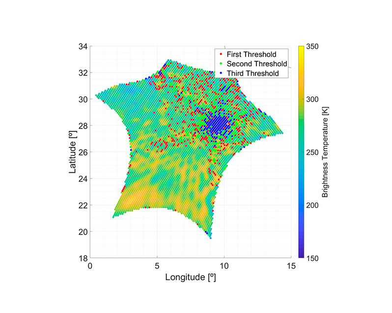
1. RFS Scan

Detecting interference in satellite data, at scale.

Our in-house software for detecting, locating, and analyzing radio-frequency interference in
data from a wide range of satellite instruments. Built and refined across multiple projects,
RFI Scan processes large data volumes to identify interfering signals that compromise
measurement quality, a capability increasingly critical as the RF environment grows more
congested.

Core capabilities:

  • Detection and localization of RFI in satellite data.
  • Analysis of interference patterns across instruments and regions.
  • Large-scale, automated processing of EO datasets.
  • Continuous evolution through real mission projects.
  • Integration into operational data quality workflows.
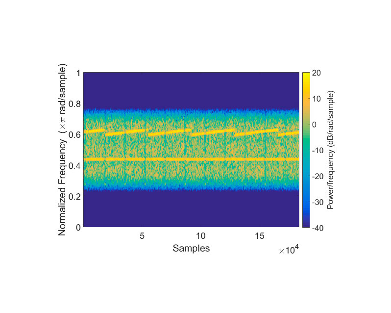
2. Radio frequency simulator

Recreating interference to
design better instruments.

Our RFI simulators reproduce interfering signals to assess how they affect sensors, quantify sensitivity losses, and test detection and mitigation strategies before launch. The tool supports end-to-end testing and performance–complexity trade-off analysis, making it a key asset for validating mitigation capabilities in future missions and reducing technical risk during design and development.

Built for design, testing, and validation:

  • Realistic simulation of RFI signals across scenarios.
  • Quantification of sensitivity and performance losses.
  • End-to-end testing of detection and mitigation strategies.
  • Performance vs. complexity trade-off analysis.
  • Risk reduction in early design and development phases.

3. Marine Plastic Detection

Tracking ocean pollution from space.

We develop EO-based solutions to identify marine litter from satellite data, generating
environmental indicators and enabling large-scale monitoring of ocean pollution. Our
approach combines research into pollutant behavior with advanced detection algorithms —
and is shaped through active collaboration with UNEP and ESA on EO indicators and
mission concepts for monitoring floating matter, including marine litter.

From satellite signal to ocean indicator:

  • Satellite-based detection and mapping of marine litter.
  • Environmental indicators for ocean pollution monitoring.
  • Research into pollutant behavior and EO detectability.
  • Collaboration with UNEP and ESA on global indicators.
  • Contribution to mission concepts for floating-matter monitoring.

Whether it's a mission, a project, or just a conversation, we're open to it.

Get in touch